ZALA unmanned systems in Antarctica

In October, the Arctic and Antarctic Research Institute purchased the ZALA 421-08M ARCTIC unmanned complex for ice reconnaissance during expeditions. Now scientists are using the unmanned complex on the shores of Antarctica. The Assistant Head of the 65th Russian Antarctic Expedition, Andrey Vladimirovich Mirakin and the geophysicist Svetlana Dmitrievna Grigorieva told us about their work and also shared their impressions about the use of unmanned ZALA systems:
A brief summary of our work
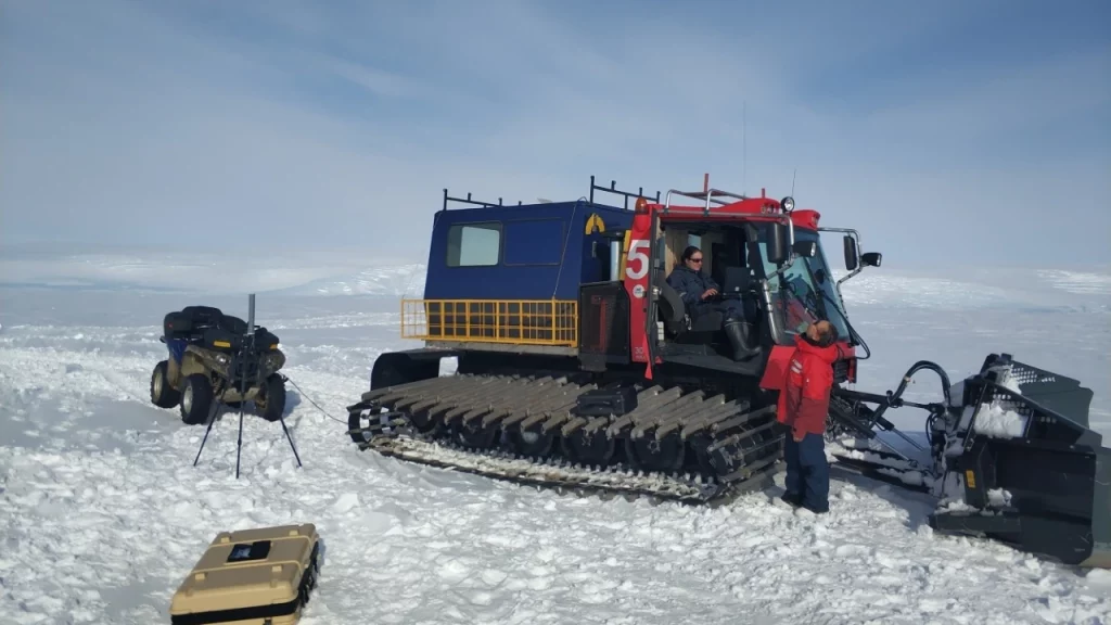
The Russian Antarctic Expedition, the main operator of the Russian Federation in Antarctica, solves the widest range of tasks - from maintaining and supplying year-round and seasonal polar stations to supporting all Russian scientific research on the icy continent. In the 65th RAE season we use ZALA drones at Progress station, Larsemann Hills oasis, East Antarctica.
Why do we need drones
The coastal Progress station is one of the busiest stations in the Antarctic. In addition to a large number of scientific programmes, a huge volume of logistical operations for supplying Vostok station, which is located 1400 km from the coast, is concentrated here.
To deliver the cargo to Vostok station we need to provide a safe way for the equipment: a scientific expedition vessel should approach the station, cranes and tractors should deliver the cargo to the shore, and from there - to the point of formation of sledge-caterpillar approaches. The danger is posed by cracks, which can reach several dozens of metres in width, hidden voids, bursting water bodies and floods that can destroy the route. Therefore, it is important for us to identify the place of thaw formation in time, to determine the position of cracks of tidal genesis.
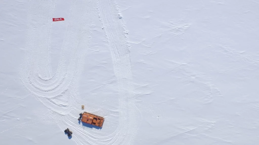
Using the ZALA 421-08M unmanned system, we conduct ice reconnaissance, track dangerous hydrological objects, and conduct aerial photography to create a cartographic basis for all engineering surveys.
Results of the application of ZALA BAS
We performed ice reconnaissance along the route of the scientific expedition ship to Progress station. After the glacier melting in March 2019, there is a large number of icebergs near the coast, and it was important to assess their position and size in order to adjust the ship's route. In addition, we found wide tidal crevasses in the sea ice. During unloading operations it would not be possible to force them with tractors, hence, during the ship's journey it was important for the ship to overcome them by getting closer to the station. Ice reconnaissance of this kind is usually carried out from a helicopter based on board the ship, but the use of drones is a more than effective alternative.
Flights were also made over the glacier section, within which the unloading route passes. Analyses of area orthophotos and height maps allowed to identify the areas where cracking is most likely to occur and to plan detailed surveys there.
In addition, we started monitoring of hazardous hydrological objects. The study area is characterised by the presence of glacial lakes that burst as a result of meltwater overflow and erode adjacent areas. We plan to survey such objects on a monthly basis, and the subsequent analysis of orthophotos and height maps will allow us to establish the feeding areas of such water bodies and the dynamics of their filling.
Our opinion about BAC ZALA 421-08M
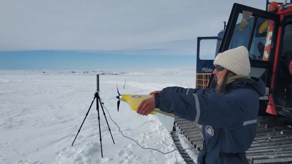
In brief, of course, it is a delight. In more detail, the drone copes with all the tasks for which it was purchased. So far, the priority of tasks allows us not to conduct flights in extreme weather conditions, so it is difficult to judge its behaviour in strong wind or frost.
The range and flight time are very satisfying. With a stated flight time of 80 minutes, we flew for a maximum of 102 minutes on one battery, and in general there was still some charge reserve. The greatest distance from the take-off point was 15 kilometres, with stable radio communication. In a quiet mode, we could cover an area of 2 square kilometres with one battery.
The quality of the photos is also excellent! As the terrain is quite tricky at times, we don't take any risks and fly quite high, sometimes up to 400 metres above sea level. Nevertheless, on the orthophotos you can easily see our tracks, 30 cm wide cracks, seals, not to mention large objects like buildings, cars and icebergs.
Drone quality and specifications aside, the coolest thing is the level of technical support. We constantly mentally thank our instructors from the Training Centre for the way they worked with us. In normal operation mode, we did not encounter a single situation that we could not have handled with the knowledge that the guys put into us.
Another great feature of our drone is its ease of maintenance. When you are 15,000 km away from the nearest service centre, it is extremely important to be able to carry out maintenance and minor repairs on your own.
As you realise, our application conditions are non-standard, but the instructors are always in touch with us, sending recommendations and even video instructions if necessary.
We wanted to give an unbiased review and didn't plan to write an exclusively positive review, but we can't do it any other way because we really love it!
Thank you, ZALA AERO and a special thank you to your favourite Training Centre!