Aerial photography is the best way to obtain detailed information on the condition of extended objects.
Thanks to the use of gyro-stabilised platforms, our aerial images are as sharp and clear as possible.
Photo resolution is up to 42MP.
We also provide server storage and guarantee complete confidentiality.
As a result of the data processing you receive:
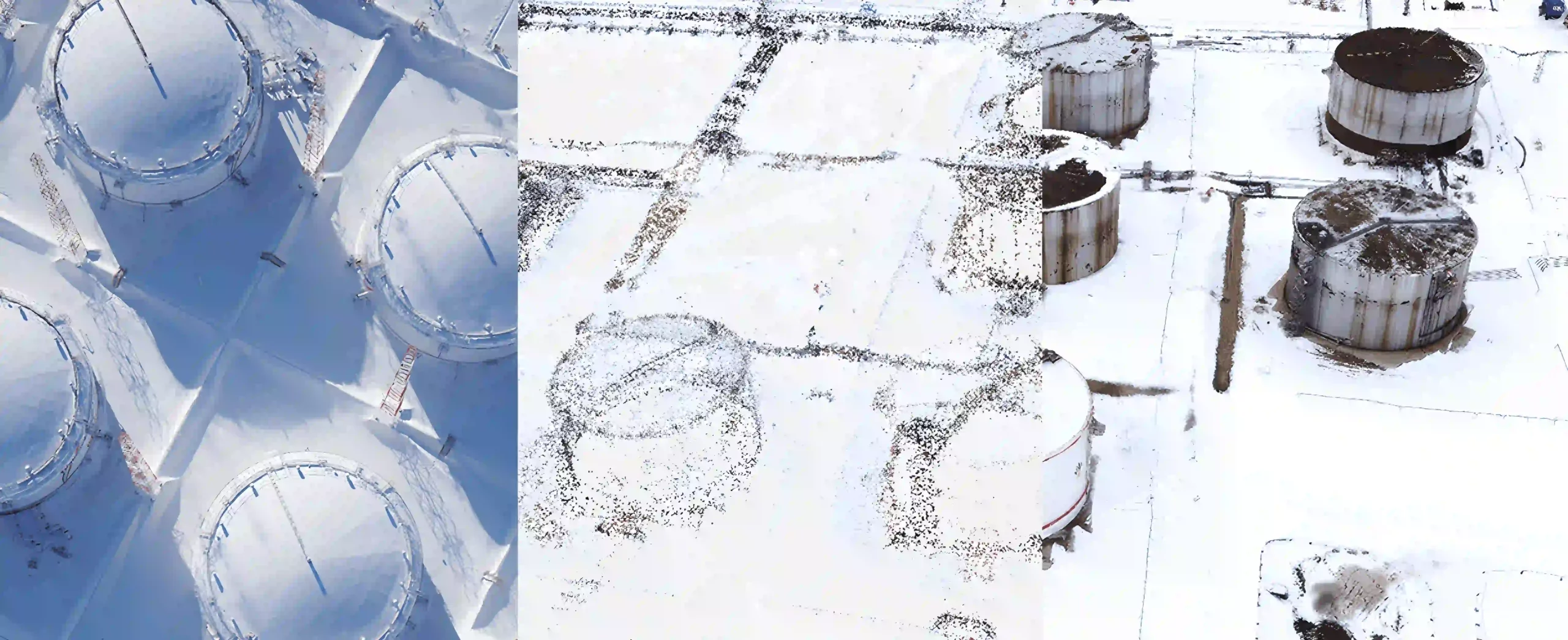
- Orthophotoplane. Maximises the authenticity of the Earth's surface. Resolution - up to 5 cm per pixel. Widely used for creation of topographic materials, cadastral maps, etc.
- A dense cloud of dots. Represents a set of points on the surface of an object. Can be used to build high-precision 3D models.
- Digital surface model. Contains information about the relief of the ground surface, taking into account the objects that are on it: vegetation, buildings, etc.
- Digital Elevation Model. Represents a map of ground surface elevations excluding vegetation and other terrestrial features.
- 3D model. Three-dimensional model of a terrain or object based on a dense point cloud with georeferenced coordinates. Thanks to the use of textures, the 3D model looks realistic.
Want to order aerial photography services and find out the cost?
Send us a formal enquiry to info@zala.aero
Or call the phones:
We look forward to helping you!
Videos
VIDEO
Security of public events