Airborne laser scanning is the most efficient method of acquiring geospatial data.
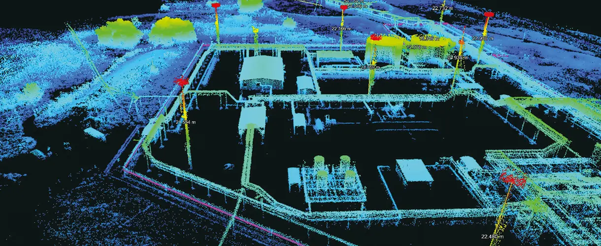
Detecting hidden objects. High density of measurements allows to «penetrate» surface layers (tree crowns, vegetation), detect visually hidden objects and accurately determine their physical dimensions.
Object Identification. The laser scanner emits a pulse at a high frequency and captures the reflections.Objects of different densities reflect the pulse with different intensities, so objects made of different materials can be identified
Measurement of objects. Measurement accuracy is up to 1 cm in plan and height.
Creation of three-dimensional models. The three-dimensional surface model obtained as a result of VLS allows to examine objects in detail from any angle. Data processing speed is less than 1 hour from the moment of scanning.
Frequency: 500,000 measurements per second.
Measurement density: 250 points per square metre.
VLS technology is especially effective for works during the development of new fields, inspection of power lines, determination of relief under dense terrestrial vegetation.
For multi-level analysis of the underlying surface, a video camera, a photo camera, a multispectral camera, and a thermal imager can be combined simultaneously with the laser scanner.
Want to order laser scanning services?
Send us a formal enquiry to info@zala-aero.com
Or call the phones:
We look forward to helping you!