Multispectral imagery provides an opportunity to determine the quality of vegetation on the ground surface.
It is a major tool for agriculture as an effective way to increase yields, improve the quality of agricultural products, reduce costs and recoup your investment as soon as possible.
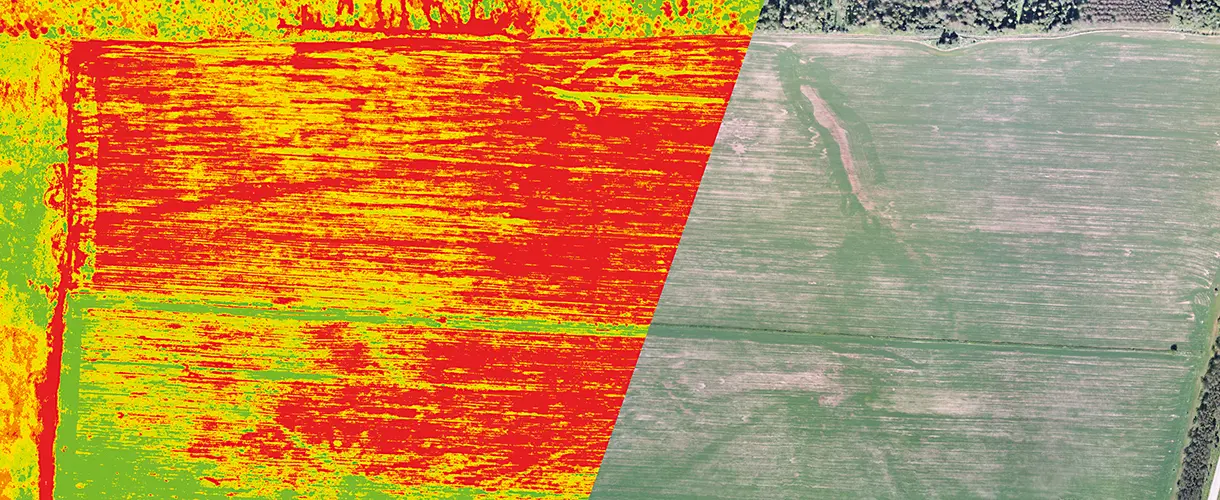
As a result of data processing you get maps of vegetation indices (NDVI, PVI, WDVI, SAVI, LAI, etc.) by which you can estimate the productivity of agricultural land, namely:
- plant health
- moisture content
- nitrogen content
- chlorophyll content
- biomass growth
Multispectral imaging, aerial photography and video monitoring in a complex allow to carry out an inventory of agricultural land, assess soil quality, control agricultural operations, assess the condition of plants, identify negative factors in a timely manner and forecast yields.
Would you like to order multispectral imaging services?
Send us a formal enquiry to Info@zala-aero.com
Or call the phones:
We look forward to helping you!