Obtaining geospatial data using unmanned systems is less labour intensive, more accurate and faster than traditional methods.
The quality of the resulting cartographic materials is influenced by the following factors
the following three factors:
- quality and resolution of images obtained from the PBC;
- positioning accuracy of the UAV during aerial photography;
- quality of the subsequent processing of the photographic material.
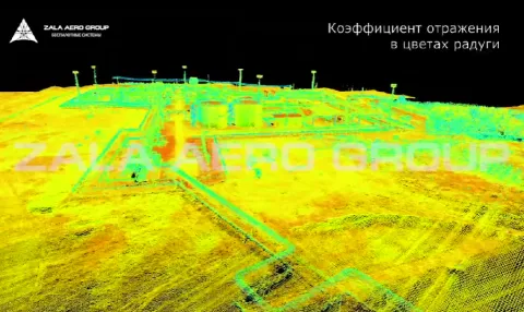
Therefore, the distinctive feature of our unmanned systems are: advanced target loads: 42 MP cameras, thermal imaging cameras and laser scanners, which provide the most detailed information about objects and ground surface; extremely accurate positioning of UAVs during surveying thanks to on-board geodetic equipment; decoding of images is carried out using modern software based on computer vision technologies.
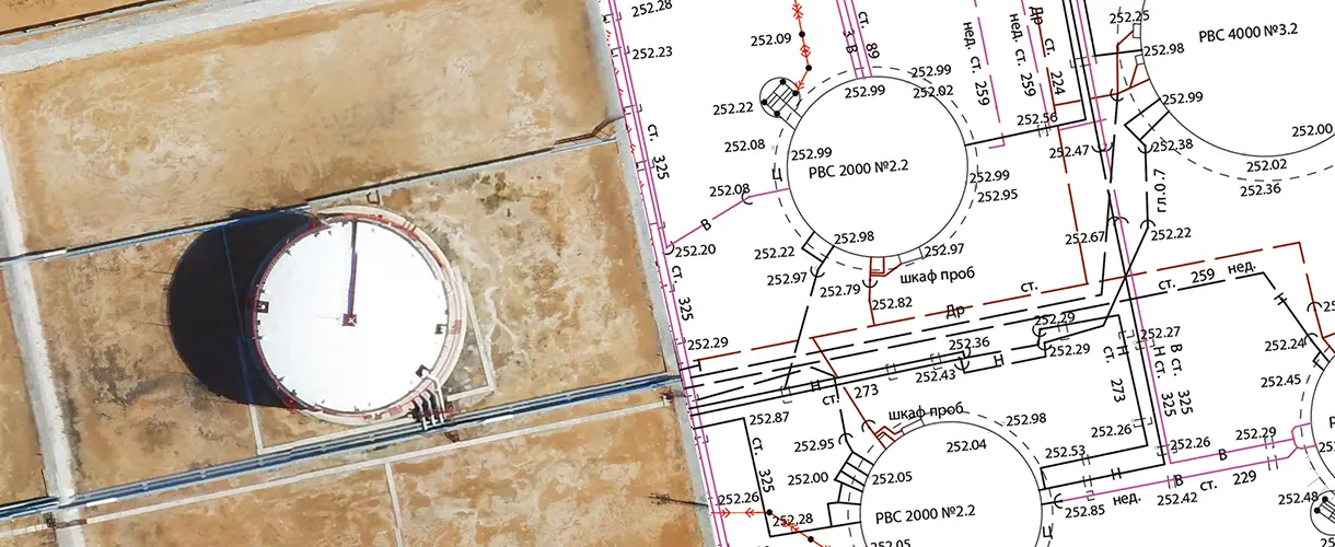
The resulting geospatial data is further utilised for:
- creation and updating of cartographic material;
- land surveying;
- detecting violations of the land cadastre;
- surveying support
Want to order aerial monitoring services or purchase a drone system?
Send us a formal enquiry to zapros@zala.aero
Or call the phones:
We will offer the best solution for your needs!
Videos