The use of Artificial Intelligence (AI)-based software enables deeper and more efficient analyses of Big Data generated by drones. ZALA not only develops such solutions, but has been successfully applying them in real-world applications for several years. The proprietary platform has repeatedly proven its effectiveness and helped to qualitatively transform customers' production processes.
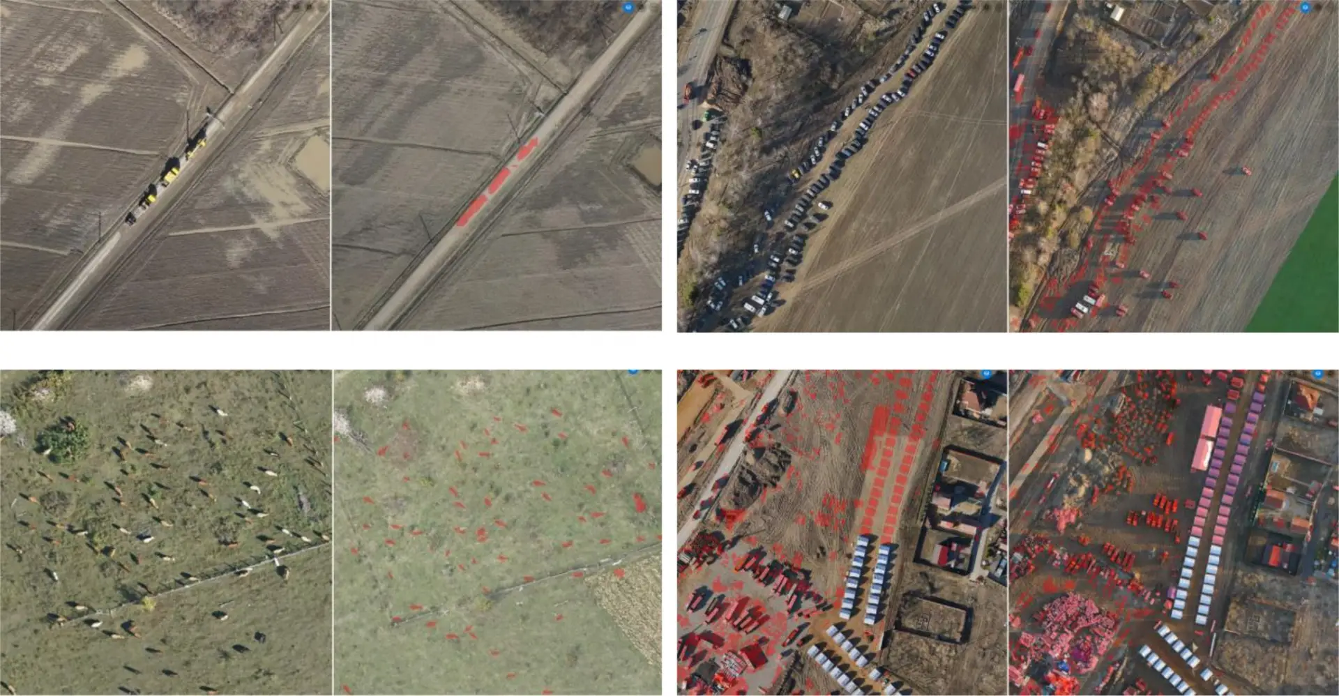
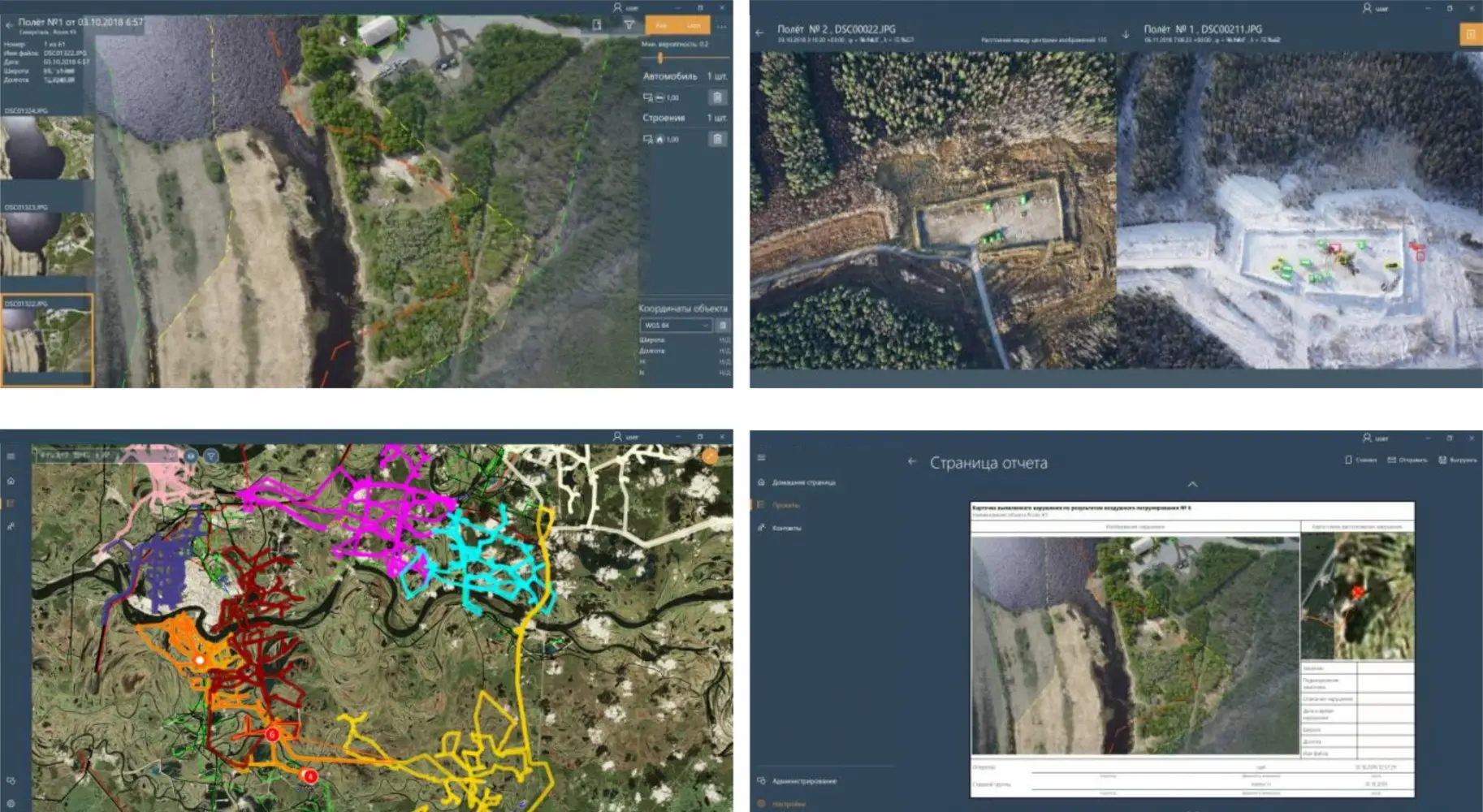
Intelligent information system for identification and classification of various objects on terrain images obtained from unmanned aerial vehicles.
An advanced computer vision system based on artificial intelligence and machine learning that identifies technical defects and anomalies from aerial photography. The programme processes images significantly faster than a human, and with a level of accuracy that surpasses that of a human.
Artificial intelligence based software solution to identify terrain changes that have occurred over different time periods.
The software provides detailed information about the state of the ground surface for different times and allows to evaluate all changes. The applied algorithms allow multi-stage analyses to detect and classify changes of dozens of different types. The system has many useful functions, such as: filtering of change masks by their characteristics, search by coordinates, measurement of change size, layer-by-layer data display, selection of areas of interest for point analysis and others.
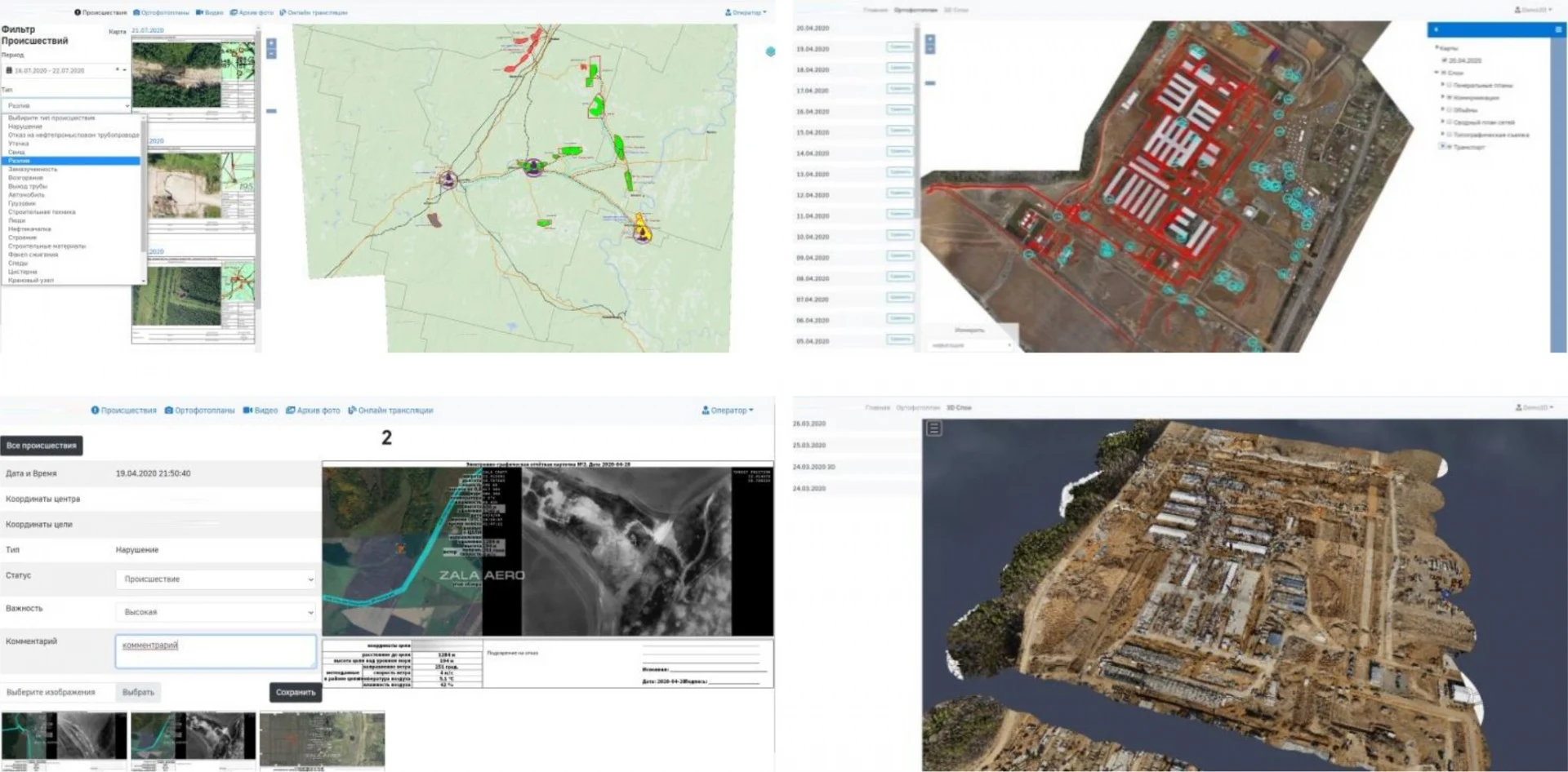
A global monitoring system combining data processing, storage and transmission functions.
The programme provides access to information at all stages of air patrolling: viewing online broadcasts, viewing the results of automatic decryption, orthophotomaps, photo and video materials, viewing detected changes. The customer gets prompt access to all materials of monitoring of its infrastructure for timely taking measures to eliminate detected violations.
The use of global monitoring system in technological processes of the enterprise allows to increase the speed of management decision making, improve interaction between production units, as well as to organise work with the Contractor.
These technologies, among other things, are designed for information modelling and aeromonitoring at all stages of engineering surveys, construction and operation of capital construction projects.