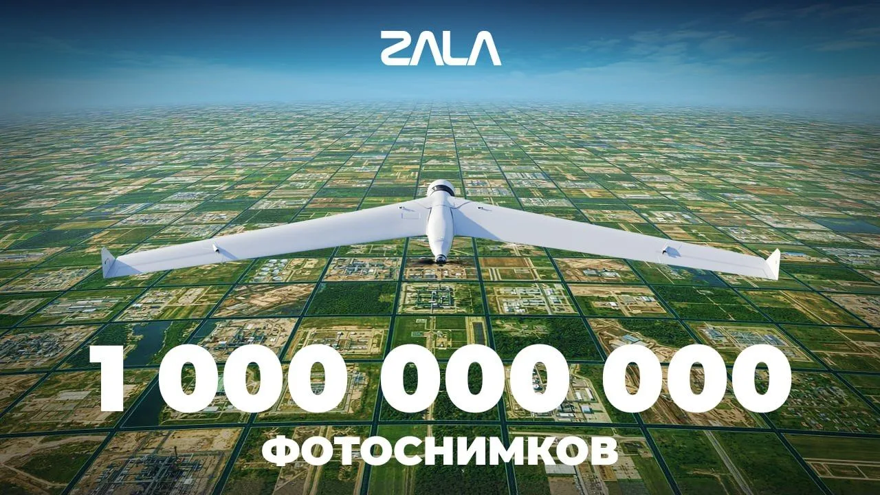
ZALA's 1 billion aerial photos: large-scale monitoring of the fuel and energy complex infrastructure
Since 2011, ZALA has been consistently changing the approach to monitoring fuel and energy complex facilities. The active use of ZALA UAVs in the industry has allowed for the creation of a unique archive of visual data.
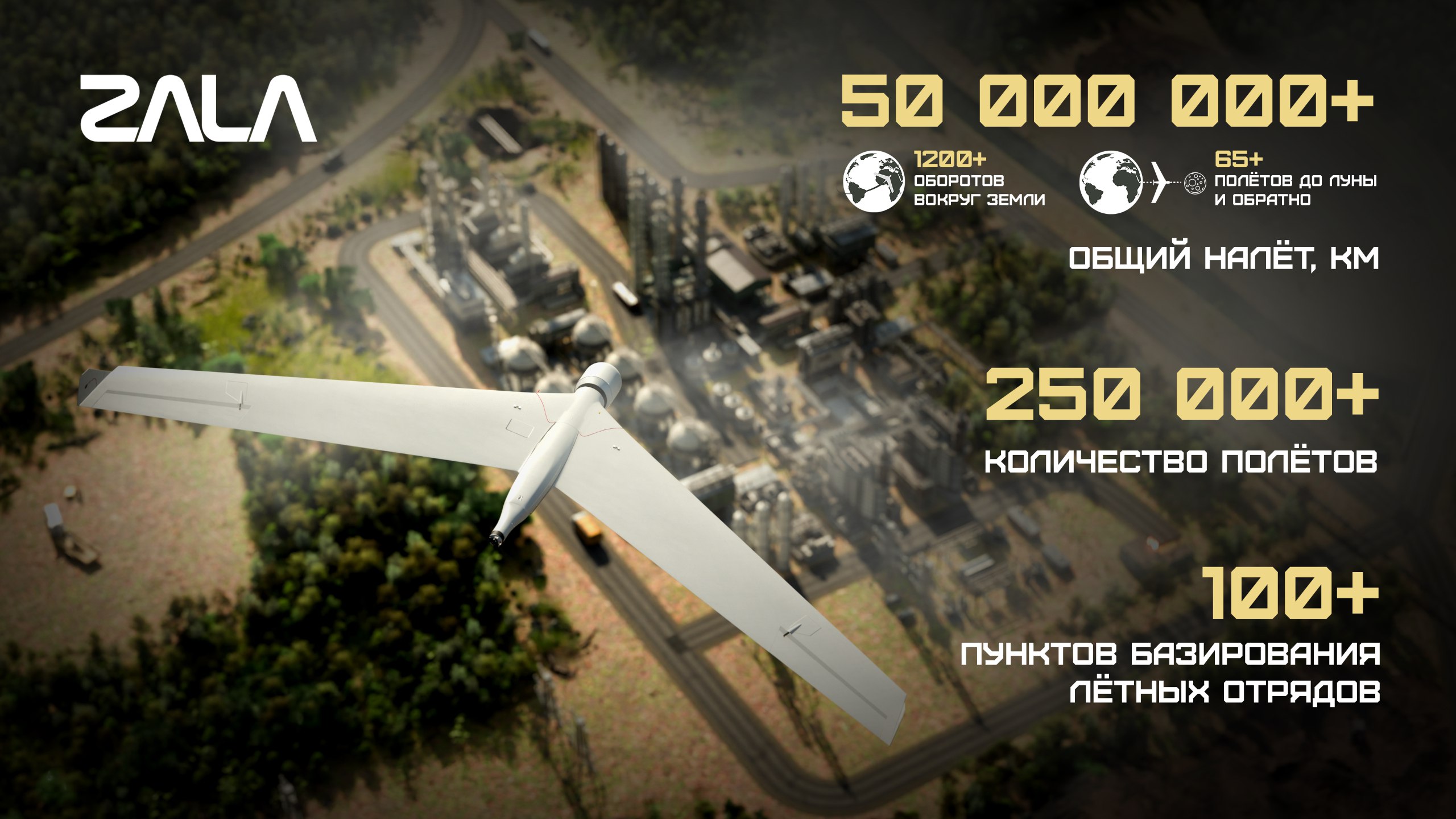
As of today, it numbers over 1 billion photos, and the total surface area recorded reached 450 million square kilometres. This is comparable to if we had filmed the entire surface of the Earth three times – from the largest continents to the smallest islands. Or it would be like covering the entire current territory of the Russian Federation with filming 26 times.
The processing of such a large data array is ensured by the specialized ZALA software ecosystem. The «GeoHorizon», «GeoDynamics» and 4Z1 software operate as a single mechanism, turning each image into valuable applied information.
«Геогоризонт» uses neural networks to analyse photographic materials and automatically identify objects of interest to customers.
The next stage is «Geodynamics». Its computer vision algorithms track the slightest changes in terrain on orthophotos and compare them with previous surveys. 4Z1 Digital Platform It is responsible for the storage, organisation, and exchange of data, ensuring deep integration of all system components into a single information network.
As a result, aerial survey data from ZALA UAVs provide predictive analytics, planning, and risk management for critical energy sector facilities and other industries.